Table of Contents
Spatial Statistics Definition
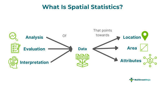
Spatial statistics is the study of spatial data by efficiently examining it to model data and obtain more information. It is focused on geometric or geographic properties. In simple terms, it represents the analysis, evaluation, and interpretation of data that contains and points toward a location, area, or attribute.
Such statistics are widely used through several analysis techniques, computational models, and algorithms that play a key role in Geographic Information Systems (GIS) to derive the feasibility of a location, make predictions, find solutions, and model problems that have a geographical feature or aspect linked to it. It is also called spatial statistical analysis.
Key Takeaways
- Spatial statistics is modeling spatial data, specifically location-based, and processing information based on geographic properties.
- There are five types of spatial statistics: geostatistical, descriptive, inferential, econometrics, and exploratory statistical analysis.
- The spatial data is typically of two types, geometric and geographic, and is expressed in different formats, mainly vector and raster.
- It is widely used across industries and a variety of sectors by companies and governments, and its absence may bring daily life to a halt.
Spatial Statistics Explained
Spatial statistics is the study of spatial data to obtain geometric and location-based information from it to use for different purposes and further information and deduction. In simple terms, spatial analysis provides numerical or quantitative information of any physical entity in a geographic coordinate system. The former signifies the natural world through lines, points, and polygons, whereas the latter is a pixel grid representation in which each pixel indicates specific information.
Spatial statistics has a wide scope of applications and is not restricted to any one industry or field of work; apart from the mapping of physical objects, it helps in decision-making and creating a plan of action based on the insights. Typically, it may remain unnoticed, but in the modern world, spatial statistical analysis plays a key role in the everyday routine and daily lives of the people observed as an omnipresent technology.
Spatial analysis plays an integral role in several industries, such as banking, healthcare, forestry, and astronomy, and is readily used by large corporations, governments, and non-government institutions. Only with the help of spatial analysis can location-based information about any region, area, physical object, element, and qualitative data be determined.
Types
The types of spatial statistics are as follows:
- Descriptive - It is the combination of spatial and descriptive statistics commonly used in GIS and typically involves quantitative data analysis.
- Inferential - This type of spatial analysis helps in hypothesis testing of a population or set of observations.
- Exploratory - The analysis majorly focuses on specific characteristics of geographical data to describe the spatial distribution, its visualization, heterogeneity, and identification of atypical locations, outliers, and spatial patterns.
- Geostatistical - This method helps analyze environmental data, such as rainfall, weather reports, and other natural phenomena; it is generally used by the mining and petroleum industries.
- Econometric statistics - This type of analysis is employed when a researcher is concerned about the estimation of empirical models and the consideration of spatial externalities. The econometric analysis focuses on formal specification testing.
Examples
Below are two examples of the concept for better understanding:
Example #1
Spatial statistics journal, in general, refers to the evaluation of location-based characteristics of data. It looks for correlations and patterns in a dataset or recorded observations, which are generally in two forms. Firstly, a point process is focused on a particular location-based event. A good example of such is the study of the position of a particular tree type in a forest. It helps the forest department and local authorities to understand the growth, impact, and spread of the tree type.
Secondly are continuous or geostatistical processes that collect data from point locations but represent it in a continuous measurement. This type of spatial statistical analysis helps in weather forecasting, rainfall prediction, and other natural phenomena. Apart from these, typical examples of spatial statistics are in the application of 2D maps, traffic control, GPS monitoring, natural disaster reporting, satellite positioning and data analysis, agriculture and farming, public health management, urban planning, and development.
Example #2
For a second example, a case study on the pork tapeworm in Colombia uses mapping and spatial statistics to improve neglected tropical disease control efforts. Neglected tropical diseases (NTDs) are characterized by specific geographic patterns that are studied through spatial statistics. Normally, secondary data on neglected tropical diseases is used. With the help of mapping and spatial statistics journals, the advanced quantitative methods helped the country to plan and design epidemiological studies and national control strategies.
The approach was approximated around 120 to 140 km for spatial measurements, and the analysis reported that women with less education and displaced people were more likely to be exposed to the NTD. This helped the local authorities and municipalities make controlled efforts to prevent and restrict the spread.
Applications
Some of the applications of this concept are:
- Widely used in astronomy to study and explore the positioning and elaboration of star systems.
- The analysis is employed in healthcare, weather forecasting, agriculture, and ecosystem management.
- Provide insights related to disaster warnings and potential natural threats.
- It plays a vital role in the chip fabrication process by creating wiring structures parallel to the place and route algorithms.
- Many global entities and authorities are responsible for recovery and constructing supply chain and logistics models.
- The statistical analysis evaluates spatial data for geometric data maps and is used as a technique for GPS and 2D maps.
- Spatial statistics help in georeferencing and checking the geographic progression of a disease, allowing governments to make efforts to control its spread.